
Abstract
Monitoring orchards at the individual tree or fruit level throughout the growth season is crucial for plant phenotyping and horticultural resource optimization, such as chemical use and yield estimation. We present a 4D spatio-temporal metric-semantic mapping system that integrates multi-session measurements to track fruit growth over time. Our approach combines a LiDAR-RGB fusion module for 3D fruit localization with a 4D fruit association method leveraging positional, visual, and topology information for improved data association precision. Evaluated on real orchard data, our method achieves a 96.9% fruit counting accuracy for 1,790 apples across 60 trees, a mean fruit size estimation error of 1.1 cm, and a 23.7% improvement in 4D data association precision over baselines.
https://ieeexplore.ieee.org/abstract/document/11077662/figures#figures
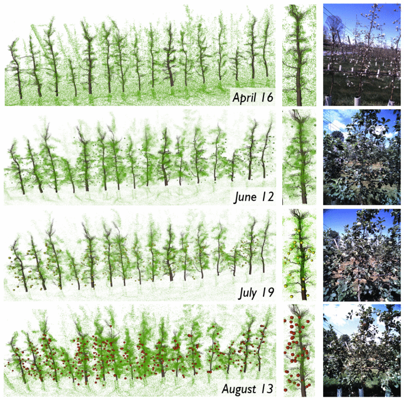
A 4D metric-semantic map of an apple orchard from April to August. Each row represents a time session. The first panel shows the metric-semantic map. The middle panel zooms in on the 6th tree, while the right panel presents its raw RGB image. Tree skeleton meshes [1] are for visualization only.