
This study aims to detect different irrigation treatments in sorghum plant breeding experiments using multispectral satellite imagery coupled with a random forest classification model. Obtained from Planet Labs’ official repository, satellite images span three sorghum test plots in Central Valley, CA, USA, covering a range of soil and climatological conditions. At each test plot, three irrigation treatments were applied: 100% full irrigation, 70% reduction, and 50% reduction to assess the drought resistance of different sorghum cultivars. A Random Forest Classification algorithm was used to detect the different treatments with high accuracy across all sites. The findings illustrate (1) the predictive capacity of PlanetScope Multispectral imagery for differences in irrigation across different sites and cultivars of sorghum, (2) the efficacy of Random Forest methods in accurately distinguishing diverse irrigation treatments using multispectral satellite imagery, and (3) the demonstrable advantage of utilizing multitemporal data over single-day imagery-based classification approaches. This work is an important step in advancing the utility of satellite remote sensing in irrigation monitoring water resources management, plant breeding studies, and supporting precision agriculture applications.
Published in: IGARSS 2024 – 2024 IEEE International Geoscience and Remote Sensing Symposium
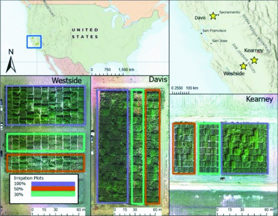
Figure: Test site locations, field layout, and irrigation